Showing posts with label cable. Show all posts

September 05, 2015

Beer & Skittles

I thought I better do another update on our whereabouts. I am steadily getting through the Maniototo posts with just a couple more to do. Actually I think three, one of them will be a two part-er. But just as I am about to catch up we move on to a new spot and do some more exploring! So if I don’t keep up with these short ‘here we are’ posts I’ll be forever coming up the rear.

Originally we were heading from Marfells Beach to Momorangi in the Marlborough Sounds for a couple of weeks of rest and relaxation (and fishing) but we had to make a detour and carry on over the big hill to Nelson to do some urgent maintenance on the 5th-Wheeler.

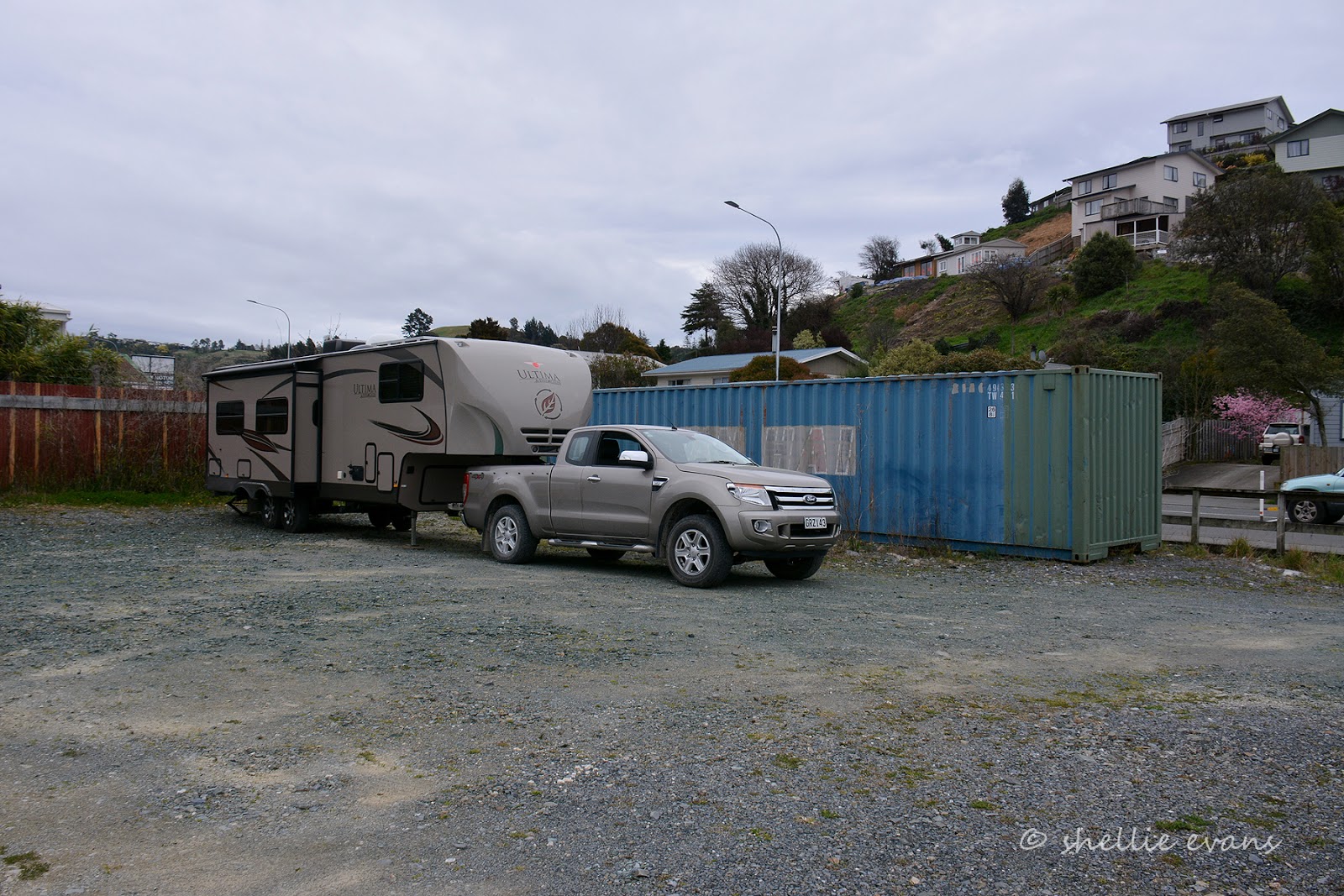
And as you can see it’s not all beer & skittles when you’re on the road- here we are parked up for the night in an overgrown empty lot with a shipping container and an old caravan for company and whole lot of dog sh*t;- David wanted you to know that after stepping in a few piles! The company who were doing the maintenance use the empty section and suggested we stay here so they could get an early start the next morning.

They offered the section again the next night but we decided to re-locate to the familiar and friendly Richmond Racecourse site where we’ve stayed a few times before. They were quite busy with a few permanents (max. allowed 3 months) and other full-timers passing through. We parked across a couple of sites and stayed hitched so we could pull out early the next morning.  It was a lovely surprise to be greeted by Shirley & Graham; they have been running the camp since the new year. We met them way down south in Manapouri last year when we were both staying at a great campground and where I took a helicopter ride to take photos of the campground.


We pulled out early the next morning and hauled ourselves back over the Rai Saddle and down into the Marlborough Sounds pulling into the DOC Momorangi Campground with enough of the day left to sit outside and enjoy the warm sunshine. That was after setting up the table and chairs for the first time this season and we also had our first taste of pesky sandflies for the season, or more to the point, they had their first taste of us. Summer is on its way!

I spoke to soon. We stayed at Momorangi for 7 days and had rain for 5 of them. It was heavy and steady for a couple of days and on and off for the rest. My hunter-gatherer decided he is a fair weather fisherman so the Takacat inflatable didn’t see the light of day & stayed tightly packed in the back of the ute. The weather, along with the fact that the blue cod fishery is out of bounds for 3 months sealed the fishing fate.


After Momorangi we headed into Blenheim to do a few chores, stopping at our regular stop, the Blenheim Racecourse. Another not so ‘beer & skittles’ park over, the grass areas were very boggy and rather than venture into our favourite spot between the grandstands and avoiding parking outside the Ballet School (where we had little girls swinging on the ramp bars just below our kitchen window and Mums parking their cars beside our front door) we backed in beside the tote office. Keeping well clear of doorway where the tractor is stored. Tractor? Too late. 7am the next morning the door is scrapped open across the gravel to stop right beside my bedroom window. The tractor roars & revs for about a minute before it bursts out the door on a mission. To be repeated again the following morning.


Chores done we were out of there and on our way to the DOC campground at Whites Bay. Whites Bay is located north east of Blenheim on the coast, at the bottom of the Marlborough Sounds but on the outside of the Sounds- if that makes sense.


If you headed north out of Picton on the Port Underwood Road, Whites Bay is towards the end, just over the hill is the beach settlement of Rarangi and the Wairau Plains. We came in from the Rarangi end- a steep and winding 6kms. No towing (not that, that stopped us on Queen Charlotte Drive into Momorangi) or large motohomes & vehicles are allowed further on past the bay on the Port Underwood road.


Whites Bay is a small sheltered bay (except for easterlies) that is obviously quite popular in the summer- there’s a surf club headquarters near the beach front and plenty of camp sites although all the top areas are closed off for the winter.
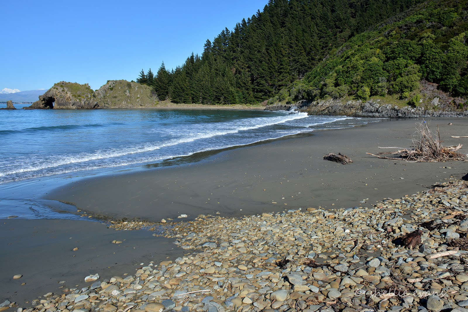

Across the bay is Cape Campbell and Marfells Beach. Whites Bay is named after Black Jack White, an American Black who deserted his whaling ship in 1828 and lived with Maori in the bay.


In 1866 the first of many telegraph cables between the North & South Islands was brought ashore at Whites Bay. The telegraphist's building that had been prefabricated in Australia was floated ashore and sits, preserved, in the middle of the DOC camp. 


Tonight while I was doing the dishes I heard the familiar sound of a couple of possums challenging each other just outside the van- it’s a weird noise and so loud that if you didn’t know what was making it you’d be quite worried and perhaps think a herd of cattle beast were about to rampage through the camp. David went out with his head torch on to locate them, he found them both close by. Well he found one and I heard the other one rustling about in the leaves at ground level. Beside me. Me without the head torch- that gave me a bit of a fright until it ran up the tree. David shone his torch on it while I shot it….with the camera  Cute eh?


Today we explored the Port Underwood Road (I’ll do a post on it later), initially we were just going to drive the road along the coast and turn around before it headed inland across to Picton but in the end we drove the whole loop- 80kms with about 50 of them on a narrow, gravel, very winding road, climbing up and over high ridges and down into tiny bays and then back up again.

There's a side road up one of the Sound arms with a monument towards the end that I had set my sights on seeing but when we got to the turnoff I had second thoughts. 14kms there and 14kms back on a similar or probably worse road just to see a monument- my head said “Don’t be silly”, the wanderlust in me said ‘Go for it”. This time my head won. David was pleased.

That got me thinking.....and so, I'm going to dedicate this post to my number one fan. A person who reads every blog post word for word and at least twice and probably 3-4 times and then asks when the next one will be posted. This person is the one who gave me the genes for my wanderlust and thirst for exploring the back-roads and byways, an extra special man who always took the long way home, despite the pleas from his wife and the whining kids in the back seat of the car.  Happy Fathers Day to my darling Dad xx


October 04, 2014

Two Cables –Two Bays

Yay! We have internet access for a few days, here's the first of the Marlborough Sounds blogs.


On our way to Okiwi Bay we took a side road just out of Nelson at Hira, initially so I could check out the “Skywire” an impressive looking flying-fox capable of carrying 4 people at a time flying high up through a valley on a 3.5km return journey reaching speeds of 100kph. I fancied having a go although the mention of a backward fall at high speeds had me reconsidering for a time and as it turned out when we arrived at the place there was no sign of the highwire and nobody about, just quad bikes, paintball, horses and other farming paraphernalia.

We didn’t stop but from what I saw I think you must be transported across the farm to the site of the flying-fox. The road was narrow and with no place to easily turn around we decided to carry on to Cable Bay and have lunch before returning.

Towards the end of the road the view opened up over a large estuary with an low lying isthmus (Maori Pa Beach) in the distance, there must be a break in the sandbar that lets in the water. The road winds it’s way around the sea cliffs with numerous holiday homes built into the slope. It also looks like a serious storm has damaged the road as there are many washouts along the way. Road cones galore line the edge & wire cages full of rocks, looking like a giant’s staircase, step down the hillside to the water far below.


It’s not long before we reach the workmen, diggers & trucks and an area where the road is seriously narrow. I may have to get out and shift a few cones but the guys spot us and are very helpful if a little incredulous when they see what we have on the back. The digger moves into a drive and the trucks are far enough to the edge that we’ll be able to squeeze past. We thank them and let them know that we’ll be back past in an hour or so. “No worries, mate!” Even if we feel like we’ve inconvenienced them, they are quite happy. All part of the job.


At the end of the road there’s another isthmus, with the estuary on one side and the ocean on the other and a tiny beautiful turquoise coloured bay. The road crosses the bar but finishes at the base of Stuart Hill, an “island” which it actually isn’t as it’s tethered to the mainland by the gravel bank. Which is what I think DOC are referring to as the “nationally significant natural feature”.


The Cable Bay Walkway, an 8km walk along the coast & over private farmland, leaves from Glenduan (just north of Nelson’s Boulder Bank) & finishes here in the bay. Unfortunately (or fortunately as the case may be) the walk is closed for lambing at the moment. But I climb over the locked gate so I can walk up to the shelter and information board that is located higher up the hill.


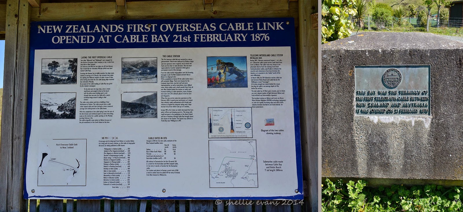
It’s here in Cable Bay that the first cable that linked Australia to New Zealand opened in 1876. Two ships set off from Botany Bay in Australia laying a cable across the Tasman Sea, averaging 6.5 knots the ships arrived in Schroders Mistake (renamed Cable Bay) just 11 days later. When the new cable system came into operation it meant that people could communicate with the friends & relatives in the “Motherland” (UK) by telegram taking 4 days instead of the usual 6 months it took by letter.


The view is spectacular- you’ll see that the top two photos form the bay. It was a surprise to see a small duck weed covered pond located just a little higher then the shoreline. It was lovely and sunny sitting outside having our lunch overlooking the bay. A few families were also about enjoying the sunshine.


Looking back down to the vehicles I see that David is engrossed in conversation and it isn’t a surprise to find him still talking when I get back down to the van. I think he should write a book on the interesting characters he meets on our travels, you wouldn't believe the stories he could tell.


It was soon time to hit the road again, we still had 60kms of winding road to travel before reaching our destination. We smiled and waved as we edged our way back past the road works and looked in again on the flying-fox operation but with no one in sight and the place deserted we decided to give that a miss for now. We wind our way up and over the Rai Saddle and down into the Rai Valley where we turn left heading for Okiwi Bay.

Just after turning we’re confronted with a plethora of signs with distances and some information on each area. This ‘arm’ of the Marlborough Sounds reaches up to French Pass with D’Urville Island across the Pass, a finger towards the end reaches into the Sounds proper and it’s where Bulwer is located 80kms away.

I’ve never heard of Bulwer before so I’m looking forward to taking a trip out that far to check it out. Our first stop will be at Okiwi Bay, we’ll then move onto Elanie Bay and maybe make it as far as French Pass with ‘Out There’ on the back.


The yellow AA signs on the right point down another road just past the main information board, down to Duncan Bay & Tennyson Inlet deep inside the Sounds.

The first section of the road down the valley is fine, just another country road with dairy farms along both sides. Then we start to wind our way up and through native bush, the road narrow but not too bad, just enough to keep us on the alert and attempting to look ahead around corners. We’ve heard that you can meet logging trucks but we’re lucky we only see a couple of cars. There’s also the mussel trucks, but we’re yet to know about those.

We catch glimpses of beautiful turquoise blue water through the trees as we get closer to the coast but for most of the time the bush is too high to get a clear view until finally a clearing gives us a wonderful view out over a bay below. This is Whangarae Bay, part of the larger Croisilles Harbour which Okiwi Bay is part of too.


Not too much further on we pass over the top of the ridge and start to wind our way down into Okiwi Bay, our base for the next few days. Okiwi Bay is a small bay tucked into the back of Croisilles Harbour with a narrow entrance which gives the impression it will be quite sheltered. Famous last words. While it hasn’t been too bad, the surrounding peaks are all over a thousand meters tall and act like a funnel with the wind either roaring down and across the harbour or up the harbour and over the top.


Down at sea level we head along the waterfront looking for the NZMCA CAP site (costs apply parking- $7 per van(2pp) per night), finding it about halfway along across from the water and just 50 meters from the boat ramp. What a perfect spot!


There’s a house truck already on site; a family of five with their dog, car & boat. They’ve not long rented out their house and are now also living full time on the road and loving the lifestyle. I can’t help but think what a handful- & how stressful it might be- they have 3 children including 22 month old twin boys who were on the go from dawn to dusk and beyond.


We set up camp on the front edge of the site and marvel at such a great spot to have a camp. And even though it’s the school holidays there’s hardly a soul about (if we look north; out the back, it’s a different story!)